
The Siege and Battle of Saybrook Fort
Saybrook Fort & the Pequot War
The Pequot siege of Saybrook Fort took place from September 1636 to March 1637 during the Pequot War.
Following the August 1636 Massachusetts Bay attack on Manisses, Pequot, and Western Niantic villages, the Pequot retaliation fell on the English at Saybrook. During an eight-month time period, the Pequot killed and wounded more than twenty English at and near Saybrook Fort. The English were attacked when they ventured far from their palisade, and the Pequot destroyed English provisions and burned warehouses while they attempted to interrupt river traffic to Windsor, Wethersfield, and Hartford.
About Saybrook Fort
Saybrook Fort was the first fortified settlement in New England, built primarily as a place of defense and protection, as well as a refuge for wealthy gentlemen from England who sought political, economic, and religious freedoms in New England. The men who initially settled Saybrook, designing and constructing the fortifications, dwellings, warehouses, and other structures knew each other well; many were soldiers and military engineers with combat experience in the Thirty Years War in the lowlands of northern Europe. The intent was to build, sustain, and defend a thriving settlement in the new world.
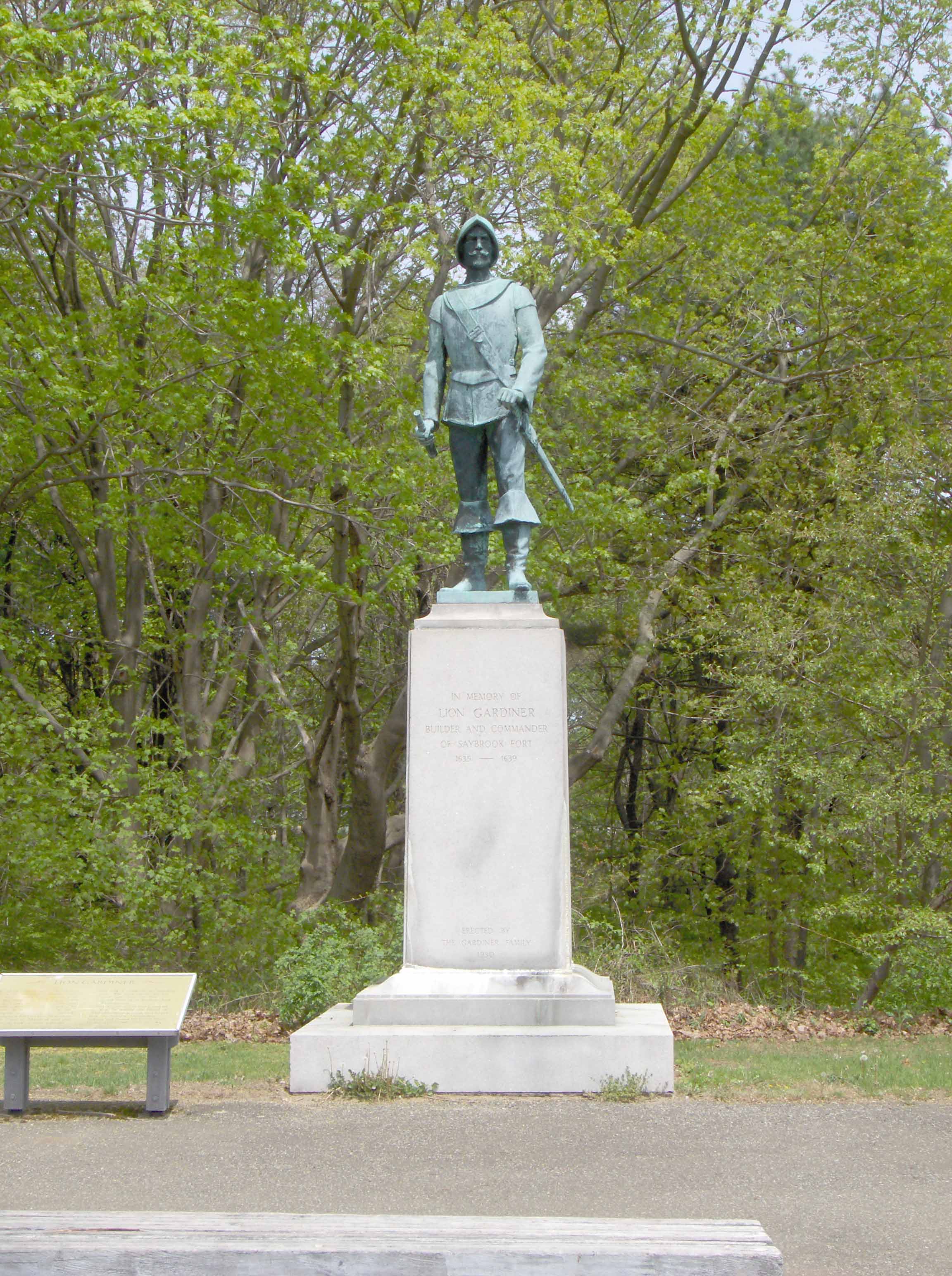
Lieutenant Lion Gardiner Statue – Old Saybrook, CT
Documentation of the Pequot War-era structures and battles at and near Saybrook Point is challenging, due to two forts constructed at Saybrook in the 17th century, Saybrook Fort and Fort Fenwick.
The first fort constructed on Saybrook Point between 1635 and 1636 and was occupied until it burned in the winter of 1647/1648. Following the fire, the fort and all the associated structure were in disrepair or entirely destroyed. In 1649, the records of Massachusetts Bay commented that during its last few years, the fort was “of no force against an enemy of considerable strength.”
Researching Saybrook Fort
The nature of the first fort’s configuration, construction, and activities have direct implications regarding the archaeological signature and the methods to identify it in the archaeological record. It is important to understand what the fort looked like in order to find it along today’s Saybrook Point cultural landscape. However, the precise nature, form, construction, and layout of the first fort has never been determined. The primary sources associated with Saybrook Fort, particularly those contained in Gardiner’s Relations of the Pequot Warr and the Winthrop Papers are frustratingly vague regarding its location and configuration. Nevertheless, when primary accounts and a military terrain analysis (KOCOA) are combined, the nature and location of the fort and structures with battlefields are inferred, and in finality confirmed through archaeological investigations.

The location of Saybrook Fort (1635-1648), does not exist in the historic record and has since faded from historical memory. The Saybrook Fort site has been attributed to the southeastern end of Saybrook Point since the early 19th century, but this assertion appears to be largely based on some confusion regarding the two forts and the location of Lady Fenwick’s tomb.
Surviving information suggested that the fort was located in the east-central area of Saybrook Point, not destroyed by railroad construction (a common misconception, due to the construction of the second fort, Fort Fenwick). Although many other colonial structures burned on Saybrook Point over the centuries MPMRC researchers believed that Saybrook Fort’s signature would be unique and readily distinguishable.
Initially, a Planning and Consensus Building grant “Siege and Battle of Saybrook Fort; September 1636 – June 1637” was conducted in order to:
- Conduct research on primary sources to identify the nature and possible locations of Saybrook Fort and associated structures (e.g. trading warehouses, domestic structures, redoubt, etc.) at Saybrook and Warehouse Points that were associated with the Pequot War;
- Identify the possible locations of actions and battles that took place in and around Saybrook and Warehouse Points during the siege of Saybrook (September 1636 – April 1637); and
- Develop a research design to identify and document the sites, battles, actions and terrain associated with the siege and battle of Saybrook Fort for future archaeological investigations.
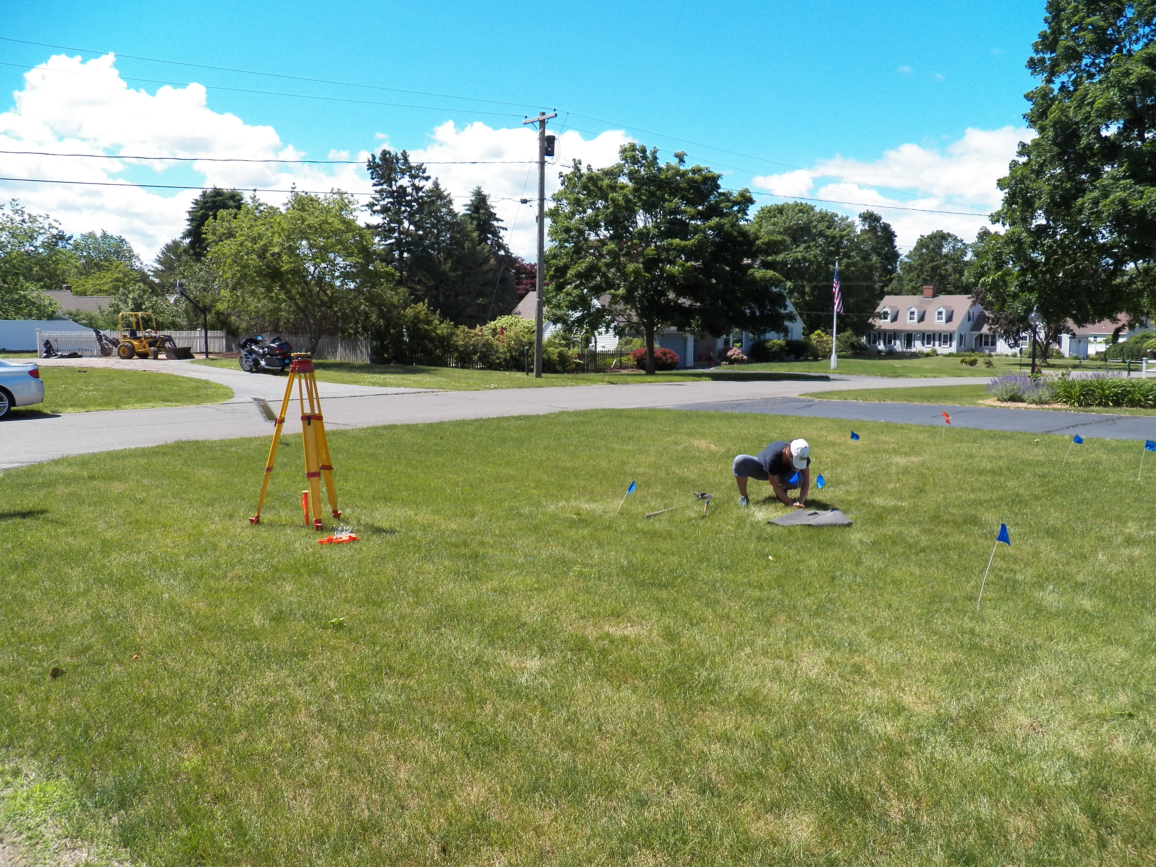
Archeology at Saybrook Fort
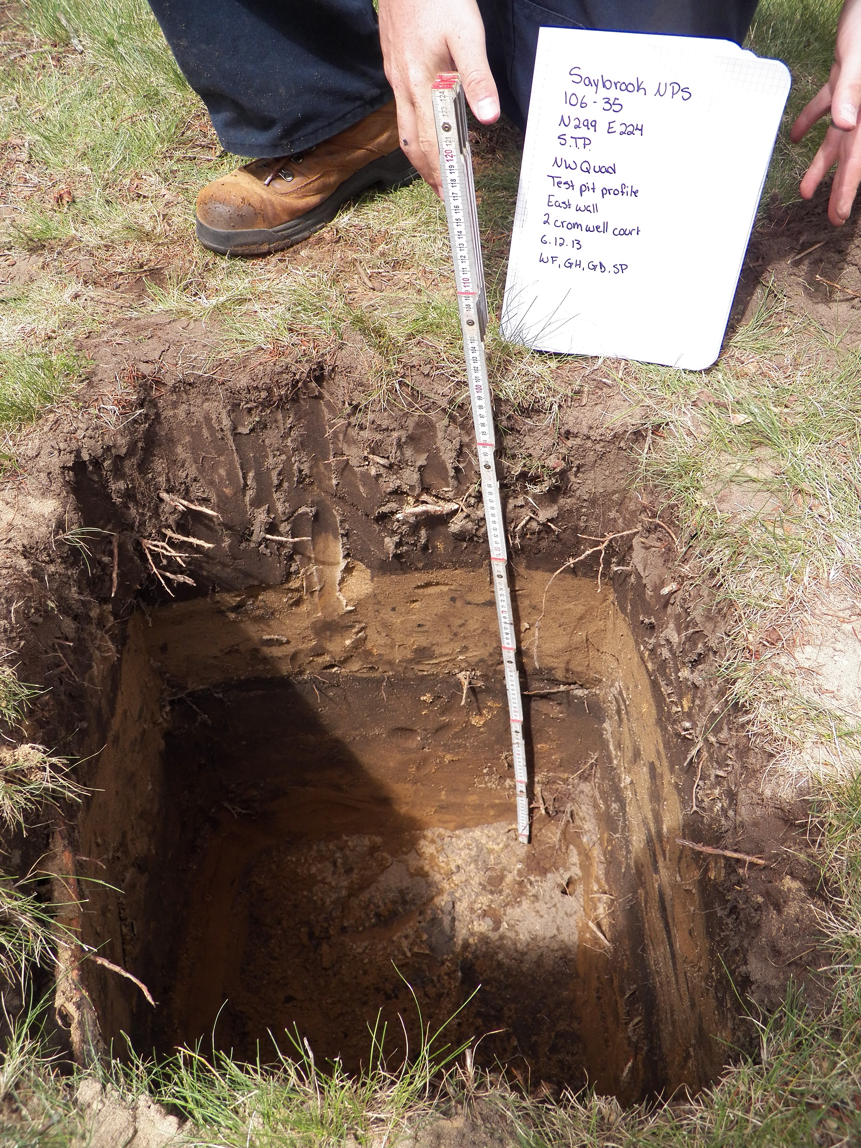 The MPMRC identified several battlefield events including the February 22, 1637 Ambush on Saybrook Neck in which Lion Gardiner and nine of his men nearly lost their lives in a Pequot attack. The site of a March 9, 1637 parlay between Pequot warriors and Lion Gardiner and his interpreter Thomas Stanton. Following the encounter the forts cannon fired hail-shot blasts in the direction of the Pequot. MPMRC archeologists uncovered evidence of where the shots impacted. Another large combat action was located on the far eastern side of the point near Gees Pond. The amount of musket balls, military equipment, and cannon projectiles indicate that several episodes of fighting took place there during the siege. Finally, MPMRC researchers believe that they have uncovered evidence of the prospective fort site and some associated structures. Much of the fort site has been impacted due to many years of farming and later house construction but two major concentrations of 17th century military and domestic objects, combined with topographical evidence from historical maps, place the prospective fort site on a higher elevation than originally thought.
The final report is currently being prepared for the ABPP. A public copy will be available once the NPS accepts all final edits. For more information on the dig or the report, please contact us!
